Fort Noble recon
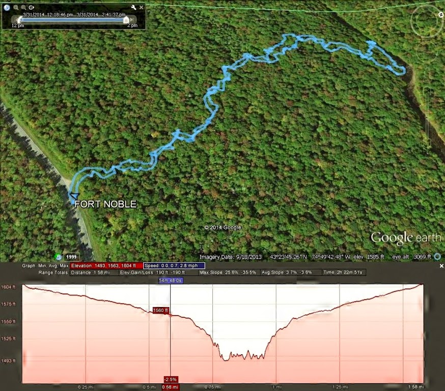
On Monday I went up into the Adirondacks to find the former trail to the Fort Noble Fire Tower. I wanted to also see if there would be an easy way to get across the south branch of West Canada Creek. The trail originally was just across the Herkimer/Hamilton County border along Route 8. It’s now unmarked but was easy to see where the break in the trees was. The snow still ranged between 1-2 feet deep in spots, so it was slow going. Eventually I did reach the river, then worked my way over to the former bridge over the creek.
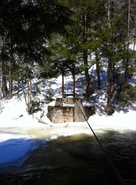
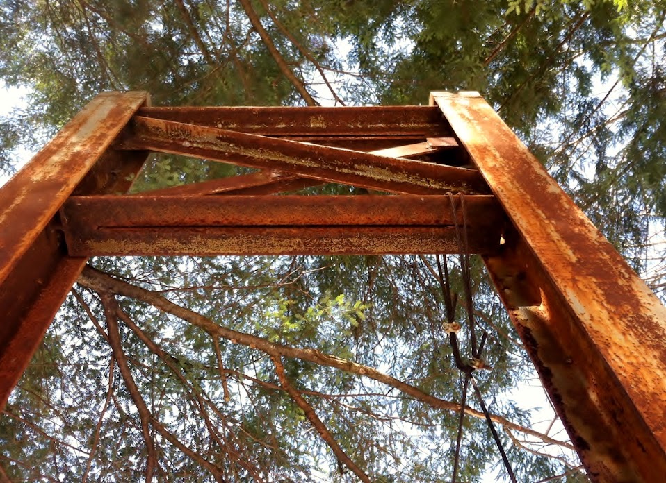
From the looks of the river, no matter what, I would get wet whenever I come back to attempt finishing this hike, once it gets warmer.

Made my way back to the car, deciding to come back when it was much warmer.
Specs:
- 1.58 miles
- 190 feet elev gain
- 2 hours 22 minutes
To see a couple more pictures from today, CLICK HERE