
Allegany State Park – A Tale Of Three Towers
pictures here
On Monday after the Bills defeated the Chiefs in Buffalo, I wanted to get some hiking in on the way home to work off the tailgating food I’d had. Doing some research I decided to continue with the summer theme of fire towers and headed down to Allegany State Park, in the south west corner of the state. This park has two areas to it, I started out in the Quaker Area of the park.
There they have an unrestored fire tower on Mount Tuscarora, and there are five different ways to hike to it. The trailhead I was looking for was supposed to be near the maintance building. Well, driving up and down the main road I could not find it. I happened to see a worker outside the building so I stopped to ask him. He didn’t know so we went inside to see if his boss knew. He did not know either but suggested I ask at the main office. So off I went. The people in the main office pointed out on the map approx where the trailhead was, and it turns out it was on the dirt road behind the maintance building, approx 200 feet away from the maintance supervisors office. While there I also asked about the location of the trail to the other fire tower on Summit at the other end of the park, they didn’t mark it on the map but assured me it was easy to fnd. We’ll see….
Back to the maintance building I went, and sure enough there’s the sign for the trail on the dirt road behind the building…

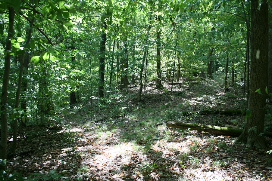
Loaded up and headed into the woods, the trail starts behind the left side of the sign. After about 100 feet or so it crosses one of the roads leading to a cabin area. You could park here but it’s not going to save much…

The trail goes up and down for quite a bit, some interesting sites like this old marker and new marker on a tree…

There are some stream crossings, but with the lack of rain they were pretty dry. The first sign of confusion I came across was an area that another trail intersected the trail I was on, going left to right. But stopping and looking, I discovered the trail I was on continued straight, past a lot of dead fall and blow down, it’s hard to see in the picture, but this is the intersection…

Some of the trees here are now marked with the old yellow blazes so i knew I was still going the right way. At one point I had stopped to look at another pile of trees down in my way, and heard some movement off to my left…

She was more curious than frightened, I may be one of the few people ever on that trail. She stood still while I got several pictures, and even after I put away my camera, climbed over the trees, I turned around and she was still in the same spot watching.
You start the majority of the elevation gain after coming down a small hill to a creek, approx 1.75 miles from the trailhead. Looking across you can see the hill climbing again. There are two trails going up. The tree blocks a switchback to the right, or you can go straight up to the left of the tree like it looks most people do…

It’ll be about 500 feet in half a mile. The trail begins to level out when you reach the first intersection with the North Country Trail, but you may not realized it, since it intersects at angle, and comes in from the left. Here’s a picture looking back at it…
Soon though you’ll come to another NCT intersection…

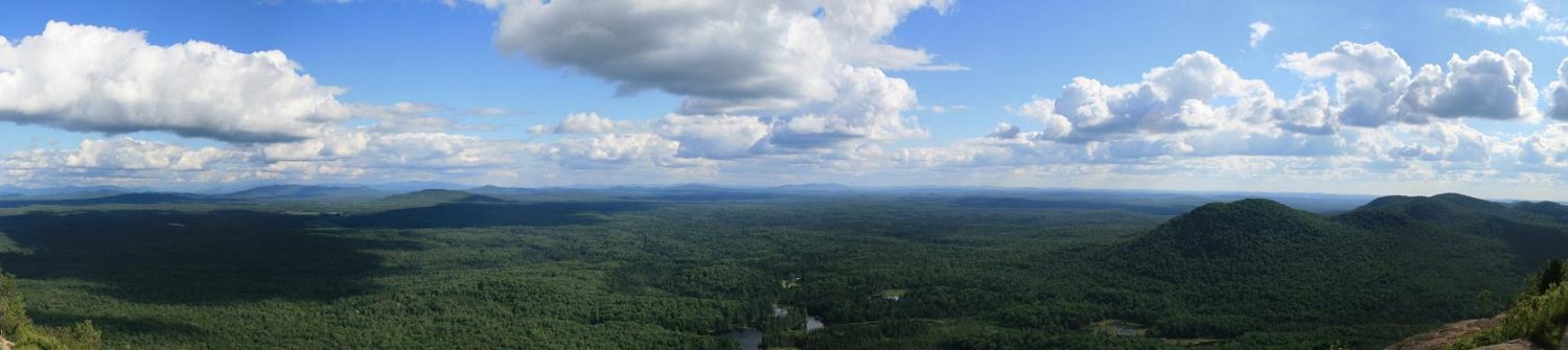
I finally caught sight of the tower, about 2.75 miles and an hour and a half after leaving the trail head…

Due to it’s rusted condition I was almost on top of it before noticing it, maybe 50-100 feet away. It’s color blends in with the trees.
You can’t climb the tower, unless you’re really adventurous. They’ve removed all the wood from the landings and the cab, only the stairs remain.

Poor photo stitch job…
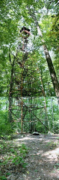
Even if they restored the tower, there would be no views, the trees have all grown up to the same height or maybe more of the tower. This has become a spot to hang out, there was a fire pit, some garbage, etc. But I had no bags with me to haul out the garbage. Next time maybe.
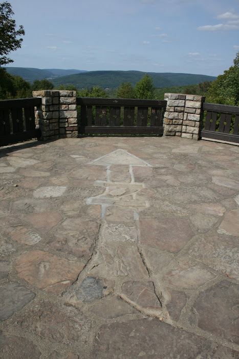
After getting back to the trail head I loaded up and headed to the Red House Area of the park. You can take the main road through the park to the other area. Stay on ASP 1, and go around the lake. Eventually you’ll see a sign on the left side of the road pointing to Stone Tower. I have not found any real info on this other than the CCC built it in 1933. The interesting thing is you can drive right up to it…
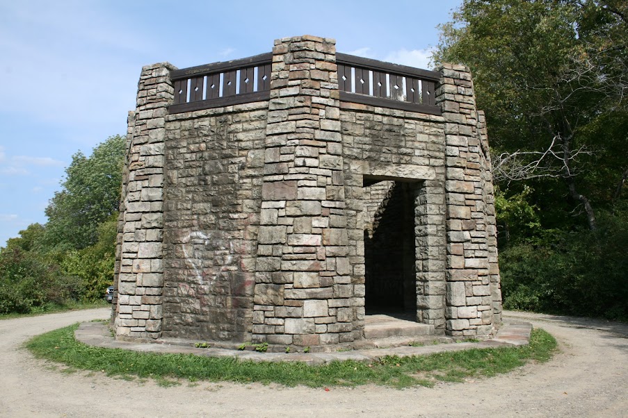
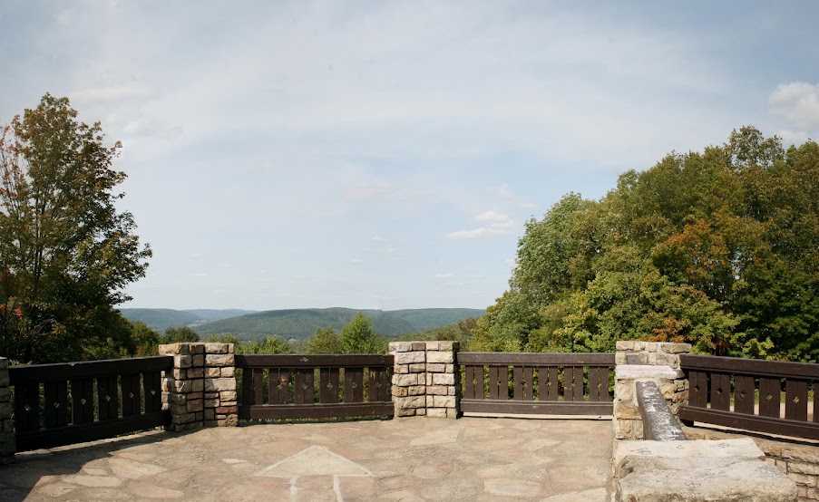
I went inside and up, one cool thing to see was the arrow pointing north laid out in the stone work…
View north…
I then continued on the dirt road, looking for the third tower of the day, a restored fire tower called Summit Hill. Turns out that is an adventure in itself.

But nothing denoting a fire tower. I continued driving back and forth and eventually decided to head back to the moutain biking trail sign. It was while looking at it that I saw this sign behind it off in the woods…

Great! But no mileage, so no clue how far back in the woods it may be. So i got all my stuff, full pack, boots, everything on and set off. The trail itself, being a mountain bike/cross country trail is a wide road through the woods…

Along the way I saw a couple of these “fireplaces” just off the side of the road. Their position and shape makes me wonder what they were used for…

The opening at the bottom is not large enough for a traditional fire, and they are only 3-4 feet tall.
Soon I came to the road split, and just past the split, you can see the tower…

My total distance from where I parked, just about a quarter of a mile. This one has a kiosk next to it to give some info on the tower, the restoration, and the observers who served there…

A quick climb up, the cab was locked, and the trees are catching up to the tower in height…

Well, it’s been a long day, and I still had a three to four hour drive home, so I didn’t hang out to long.
It’s a shame about this park. They have one trail with a tower that the employees couldn’t tell me where it was even though they work less than 200 feet away, and may have driven by the sign a lot. In addition the trail needs some work, simply clearing the dead fall and blow down could take a few days depending on your crew size. At the other end of the park you have a restored tower but no roadside signage pointing out the trailhead. There’s a lot of room for improvement.
Specs
Mt. Tuscarora
- Trail 5.48 miles
- Elev gain 1435 feet
- Time 2 hours 51 minutes
Stone Tower
- Trail 10 feet
- elev gain 0 feet
- Time 1 minute
Summit Hill
- Trail .53 miles
- Elev gain 74 feet
- Time 19 minutes